The Nanpean Gardens are situated in the Cornish Alps. A local name for the area from many years ago as the spoil from the Clay quarries was piled into large white conical heaps which resembled alpine peaks.
Now however, the peaks are now covered in vegetation, shrubs and trees and look more like hills than Alps.
For those visitors from foreign shores, Cornwall is a county of Britain in the United Kingdom. It is situated on the South-West corner and stretches out into the Atlantic Ocean surrounded on three sides by the sea which tends to have certain advantages, and of course, disadvantages too. The weather can be somewhat changeable here but on the whole it is mild, with few frosts in the winter months, hardly any snow falls here except on the moors which are bleak and empty, and higher up than their surrounds. Rainfall tends to be above average which for gardeners means that little watering needs to be done as Mother Nature takes care of that for us.
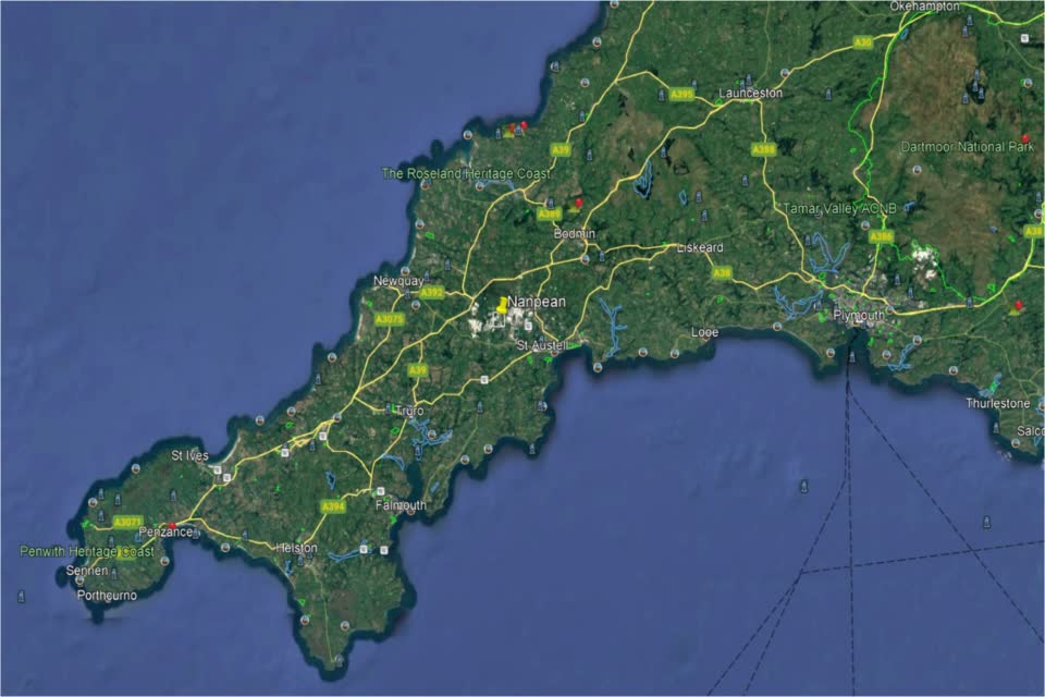
From the above map you can see a Town called Launceston, along with Plymouth on the South coast, they mark the border between Cornwall and Devon, a neighbouring county. Nanpean is located approximately in the middle of the map, Some 10-12 miles to the North coast and the same to the South coast which allows us easy access to the whole county. The one and only city is Truro which is not far from us in terms of road travel, and is a pleasant drive as the roads here are much quieter than they are in the South-East of the UK, being that the population in Cornwall, and Devon too for that matter, is far lighter.
It must be said that Cornwall and Devon are considered rural areas and populations of the towns and villages tend to be in the few thousands, rather than the hundreds of thousands predominant in the main parts of the UK. The village of Nanpean is firmly placed in the heart of Cornwall away from the regular tourist routes, which, even in the summer months tends to retain it's serenity over the coastal towns. It lies approximately 500 ft above sea level and is surrounded by what the local people call 'The Cornish Alps', due to the large and cone like hills that are made up of the spoils of Clay mining which has been a major employer for well over a 100 years. These hills have for the most part been re-wilded and where they looked white and imposing, they are now clad in green from head to toe. The top of the hills seen in the photo below used to be all white with the clay spoils, but are being covered now by not only nature, but helped on by Emerys, the clay company controlling the clay quarries who have co-ordinated a massive effort to re-wild the whole area.
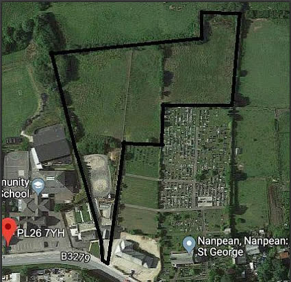
The black lines on the photo above outline our properties borders with the house at the lower part of the photo, next comes the stable block, and beyond that the Sand Ring as it was. The mound of trees separates the fields from the sand ring with the fields comprising of approx. two acres beyond that. We have the local village store next to us on one side and the old school cottages on the other, with the community school next to that.
Above is a larger area photo showing the clay pits scattered around the area. From the roads you cannot see much but some are still worked to some extent and there the white of the clay spoils can be seen from a distance.